Speed Management
Learn about speed display boards and how they are used to slow traffic.
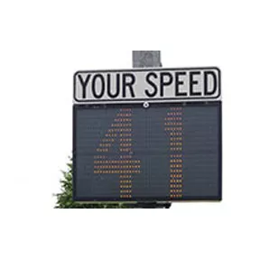
To manage speeding on our streets, The City of Markham uses speed display boards to improve driver behaviour.
You’ll see speed display boards all over Markham. These devices use radar technology to detect vehicle speeds and display it back to the driver. They let drivers know if they are driving too quickly and need to slow down. Studies show that vehicle speeds are reduced by up to 20 percent when these signs are placed.
- Speed Display Board Locations
The City has twenty four speed display boards. We put them on streets for a three month period. To consider locations for the devices, our staff review traffic conditions on the street. If staff can confirm there is a speeding problem and existing traffic signs and other measures are not working, a speed display board may be used.
If you would like your street to be evaluated, please contact the Contact Centre.
Phone: 905.477.5530
E-mail: customerservice@markham.caRight now, you’ll find speed display boards (as of April 7, 2025) on these streets:
Ward Street Section 1
Grandview Avenue Between Rayneswood Crescent and Pinevale Road 1
Old English Lane Between Carriage Hill Court and Hampshire Court 1
Royal Orchard Boulevard Between Kirk Drive and Bay Thorn Drive 2
Russell Dawson Road Between Woodbine Avenue and Markland Street 2
Victoria Square Boulevard Between Elgin Mills Road and Betty Roman Boulevard 2
Apple Creek Boulevard Between Rodick Road and Woodbine Avenue 3
Waterbridge Lane Between Juniper Crescent and Heatherwood Crescent 3
Village Parkway Between Carlton Road and Krieghoff Avenue 3
Caboto Trail Between Isabella Street and Glenbar Gardens 4
Galsworthy Drive Between Vanderbilt Road and Honeybourne Crescent 4
Bur Oak Avenue Between Dogwood Street and Mingay Avenue 4
Southdale Drive Between Gladiator Road and Lakevista Avenue 5
Williamson Road Between Maple Ridge Crescent and Willow Trail Road 5
Cornell Centre Boulevard Between The Meadows Avenue and Cinemark Avenue 5
Castlemore Avenue Between Peterkin Road and Swan Park Road 6
Yorkton Boulevard Between New Yorkton Avenue and 16th Avenue 6
Wilfred Murison Avenue Between Stonebridge Drive and The Bridle Walk 6
Glenbourne Park Drive Between Scandia Court and Major Mackenzie Drive East 7
Coxworth Avenue Between Elson Street and Fairty Drive 7
Highglen Avenue Between Walden Street and Clarion Crescent 7
Fieldside Street Between Reginald Lamb Crescent and Riverwalk Drive 8
Lee Avenue Between Kennedy Road and Noble Street 8
South Park Road Between Park Common Boulevard and Times Avenue 8
Beckenridge Drive Between Ravenhill Crescent and Windfields Road
- Enforcement
York Regional Police enforce the speed limit across the City. They also look for people who break other traffic rules. If you think that a street needs more police enforcement, please contact York Regional Police. We also encourage you to use York Region’s Road Watch Program. There, you can report aggressive drivers to police.